
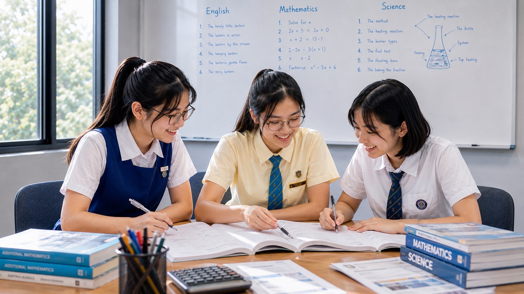
Bukit Timah is one of the rare places where a student can walk through several school subjects without changing location. A hill becomes Geography. A rainforest becomes Biology. A railway becomes History and network design. A road becomes settlement geography. A war site becomes evidence about strategy and logistics. A future housing district becomes planning, optimisation and civics. The same place keeps changing meaning because each discipline asks a different question of the same world.
That makes Bukit Timah unusually useful as a classroom — not because everything important in Singapore happened here, and not because every school subject can be forced onto one neighbourhood, but because the area contains enough visible layers of nature, infrastructure, settlement, conflict, education and future planning to let a learner practise something much more valuable than memorising facts: learning how to connect evidence across systems without confusing one system for another.
This article is a supporting pillar of What about Bukit Timah?, the live BukitTimahTutor.com hub for Bukit Timah as a place. It does not replace the specialist owners underneath it. The Geography of Bukit Timah owns the physical geography; How Bukit Timah Nature Reserve Works owns the rainforest system; Alfred Russel Wallace in Bukit Timah owns the scientific-observation story; Bukit Timah in World War II owns the wartime layer; and the Mathematics estate remains separately owned by the Mathematics Hub and its specialist pages. This page owns the interdisciplinary learning method: how one real place can teach a student to move from observation to explanation, from explanation to model, and from model back to evidence.
The Quick Answer
Bukit Timah works as a classroom because several different systems are visible close together. Bukit Timah Nature Reserve protects 163 hectares of rainforest around Singapore’s highest natural point. The Rail Corridor preserves the geometry of the former railway while functioning as a green and recreational spine. National Heritage Board trails document plantations, kampong life, schools, wartime sites and later leisure landmarks. The Downtown Line and future Cross Island Line show how transport changes accessibility. Turf City shows a live planning problem involving housing, heritage, biodiversity, mobility and public space.
None of those examples needs to become a worksheet immediately. The better sequence is:
notice → describe → measure → compare → ask why → check evidence → model → test the model → revise.
That sequence is recognisable in Geography fieldwork, Biology investigation, historical source work, Mathematics modelling and systems thinking. The subject labels differ. The disciplined habit underneath them is remarkably similar.
1. A Place Is Not a Subject — and That Is Why It Is Useful
Schools divide knowledge into subjects for good reasons. Geography develops one set of tools. Biology develops another. History requires different evidence. Mathematics has its own formal language.
The world does not arrive divided that way.
A tree beside a former railway line is simultaneously:
- a biological organism,
- part of an ecological community,
- a component of a landscape,
- a source of shade affecting human comfort,
- an obstacle or asset in planning,
- a measurable object with height, diameter and location,
- part of a historical landscape that may have changed over decades.
The tree does not choose a subject.
The learner chooses a question.
That is the first reason Bukit Timah works as a classroom. It lets a student practise switching the question while keeping the world fixed.
2. Start with Geography: Why Is Bukit Timah Shaped Like This?
Geography begins by refusing to treat location as background.
Why is the hill here?
Why do roads run where they do?
Why are some areas densely built while others remain protected?
Why did a railway once pass through this corridor?
Why are major schools and institutions concentrated along particular transport spines?
Bukit Timah makes these questions visible because topography, transport and land use overlap strongly. Bukit Timah Hill rises to about 163 metres above sea level, which is modest globally but important on a low-lying island. The ridge, surrounding streams, former quarry landscapes, road corridors and forest edges all influence what can be built and how people move.
The detailed physical-geography owner is The Geography of Bukit Timah | Hill → Granite → Streams → Forest → Urban Form. For classroom use, the larger lesson is that geography is not naming features. It is explaining why arrangements in space exist and what those arrangements cause.
3. Elevation Becomes Meaningful Only When It Changes Something
A student can memorise that Bukit Timah Hill is Singapore’s highest natural point.
That fact becomes useful only when the next question arrives.
- How does elevation affect gradient?
- How does gradient affect walking effort?
- How can slope influence drainage?
- How does higher ground change lines of sight?
- Why can a small hill matter strategically during war?
- How does topography constrain road and building design?
This is the difference between a datum and an explanation.
The number 163 metres is not the lesson.
The lesson is what that number changes.
4. Then Biology Changes the Scale
Geography often begins with the landscape.
Biology moves inside it.
Bukit Timah Nature Reserve is 163 hectares and protects one of Singapore’s most important remaining rainforest landscapes. NParks identifies it as part of the Central Nature Park Network and as one of Singapore’s two ASEAN Heritage Parks.
The useful classroom question is not simply, “What animals live here?”
Ask instead:
- What makes a rainforest different from a planted park?
- What is an ecological niche?
- How does canopy structure affect light below?
- How does decomposition recycle nutrients?
- How do species depend on one another?
- What changes at a forest edge?
- Why can an isolated patch lose ecological function even when its area remains unchanged?
Biology teaches the student to replace “green” with mechanisms.
A place can look green and still be biologically poor. A narrow corridor can look small and still be ecologically important. A species can be present and still be under pressure.
5. Primary Rainforest Is Not Just “Lots of Trees”
NParks’ current biodiversity material distinguishes primary forest as a habitat with long ecological continuity and specialised biodiversity.
That gives students a chance to learn an important scientific discipline: do not classify by appearance alone.
Two places may both look green from a road.
But biologically they can differ in:
- age structure,
- species composition,
- soil history,
- canopy complexity,
- microclimate,
- dead wood,
- understorey structure,
- seed banks,
- ecological interactions.
Scientific learning becomes stronger when the student learns to ask which hidden variables distinguish two visually similar systems.
6. Nature Parks Teach the Difference Between Core and Buffer
Bukit Timah Nature Reserve does not operate alone.
Nearby nature parks such as Hindhede and Rifle Range perform different jobs. NParks describes Rifle Range Nature Park, for example, as a 66-hectare buffer that helps protect Bukit Timah Nature Reserve from edge effects and surrounding development while enhancing ecological connectivity and providing alternative recreation.
This is a beautiful systems lesson because two green spaces can be valuable for different reasons.
- Core habitat protects ecological depth.
- Buffer habitat reduces pressure on the core.
- Recreational space gives people access without sending every visitor into the most sensitive area.
- Corridors help movement between patches.
The student learns that protection is often architectural. It depends on how parts are arranged around one another.
7. Eco-Link@BKE Turns Ecology into a Connectivity Problem
A road can improve human connectivity while damaging wildlife connectivity.
That is exactly the kind of conflict a good interdisciplinary classroom should expose.
Eco-Link@BKE reconnects forest habitat across the Bukit Timah Expressway. The ecological story is owned by How Eco-Link@BKE Reconnected Bukit Timah Forest, while the mathematical graph-theory owner is The Mathematics of Eco-Link@BKE.
As a classroom object, Eco-Link lets a student ask several disciplines one after another:
- Biology: which species need connectivity?
- Geography: what barrier does the expressway create?
- Mathematics: how does reconnecting one edge change a network?
- Engineering: how can a crossing support vegetation and wildlife above live traffic?
- Civics: how should a city balance transport efficiency and ecological continuity?
One bridge can therefore teach five different ways of thinking without becoming five different bridges.
8. Alfred Russel Wallace Shows What Scientific Observation Looks Like Before the Answer Exists
Bukit Timah is also connected to the history of scientific observation through Alfred Russel Wallace, who collected insects in the area during his work in the Malay Archipelago in the nineteenth century.
The important classroom lesson is not hero worship.
It is method.
Before a scientific theory becomes a paragraph in a textbook, somebody has to notice variation, record patterns, compare locations, preserve specimens, question an assumption and keep observing when the answer is still unclear.
The specialist history is owned by Alfred Russel Wallace in Bukit Timah | Beetles → Observation → Natural Selection → Scientific Method. In this classroom pillar, Wallace matters because he demonstrates that science begins with attention before it reaches explanation.
9. History Changes the Question from “What Is Here?” to “How Did It Get Here?”
History introduces time into the landscape.
The National Heritage Board’s Bukit Timah Heritage Trail traces the area from nineteenth-century plantations through kampong life, transport, wartime events, educational institutions, later industry and leisure.
That chronology teaches an essential historical habit:
the present landscape is evidence of previous systems, but it is not a complete record of them.
Some buildings survive. Some roads preserve old routes. Some names survive after the original object disappears. Other communities leave fewer visible traces because their structures were demolished, redeveloped or never monumental in the first place.
History therefore requires more than looking.
It requires sources.
10. Bukit Timah Road Teaches Cause, Not Just Chronology
Bukit Timah Road was developed in the nineteenth century and extended northward to Kranji by 1845.
The weak historical question is:
“When was the road built?”
The stronger questions are:
- What became easier after the road existed?
- What land became more economically usable?
- What settlements became better connected?
- What institutions later accumulated along the corridor?
- How did transport alter the perceived distance between town and the interior?
Infrastructure is historical causation made physical.
A road is not merely where people travel. It changes which futures are feasible.
11. The Railway Teaches That Infrastructure Can Outlive Its Original Function
The former railway through Bukit Timah once moved people and goods.
Today, the Rail Corridor performs a different bundle of functions: heritage, recreation, community connection and ecological continuity.
The transformation is owned in depth by How the Rail Corridor Changed Bukit Timah and Bukit Timah Railway Station.
As a classroom object, the railway asks a deeper question:
When a system stops doing its original job, what parts of it remain valuable?
The answer may include route geometry, bridges, buildings, memory, vegetation, access and social familiarity.
This is adaptive reuse at landscape scale.
12. A Railway Line Becoming a Green Spine Is Also a Systems Lesson
Systems thinking asks what changes when a component is reassigned.
The former rail corridor retains one powerful property from its transport past: continuity.
A railway needs a continuous route.
After the trains leave, that continuity can become valuable for walking, cycling and ecology.
The original function disappears, but one structural property survives and becomes useful to new functions.
This is exactly the kind of relationship students should learn to notice:
old constraint → preserved geometry → new use.
13. World War II Shows How the Same Geography Changes Meaning Under Stress
A peaceful landscape can be misread if we assume every feature always had its current meaning.
During the Battle of Singapore, Bukit Timah’s hill, roads and nearby supply infrastructure became strategically important. The same road that supports ordinary movement in peacetime can become a military supply line. The same elevation that makes a hill a recreational destination can become tactically important under conflict.
The deeper wartime owner is Bukit Timah in World War II | Hill → Supply Depots → Battle → Ford Factory → Memory.
For the classroom, the lesson is about state dependence.
A system component can change function when the surrounding state changes.
That idea appears in history, engineering, economics, computing and Mathematics.
14. Schools Teach Human Geography, Not Just Education
Bukit Timah is strongly associated with schools and educational institutions.
That can be studied as an education story, but it is also human geography.
Schools influence:
- daily travel patterns,
- bus and train loading,
- family housing choices,
- retail demand,
- after-school movement,
- the location of tuition and enrichment services,
- the social identity of a district.
The historical owner is How Bukit Timah Became an Education Corridor, while The Schools of Bukit Timah owns the institutional and mobility layer.
The classroom point is that institutions change the geography around them.
15. Beauty World Teaches How Commercial Places Acquire Memory
Commercial geography often looks temporary.
Shops open. Buildings change. Markets move. Yet some place names and habits survive long enough to become community memory.
Beauty World is useful because its history moves through amusement, market activity, fires, shopping, food, MRT access and current integrated-development planning.
The historical owner is How Beauty World Became Beauty World, while the future owner is How Beauty World Is Changing.
A student can use the pair to compare continuity and change.
- Which functions disappeared?
- Which names survived?
- Which habits remained?
- Which transport changes altered the catchment?
- Which new public functions are being added?
That is history, geography and planning in one comparison.
16. King Albert Park Turns a Familiar MRT Station into Graph Theory
The future Cross Island Line Phase 2 will make King Albert Park an interchange with the Downtown Line. LTA currently targets CRL2 passenger service for 2032.
For a commuter, this is a transport improvement.
For a Mathematics student, it is a change in network topology.
A station that sits on one line becomes a transfer node between two lines.
That can change:
- the number of possible routes,
- the number of transfers needed for some journeys,
- journey time,
- network redundancy,
- the station’s importance inside the graph.
The specialist owner is How King Albert Park Is Becoming an Interchange | Downtown Line → Cross Island Line → Network Geometry.
The classroom lesson is larger: Mathematics becomes powerful when the learner recognises a real system as a mathematical object.
17. Mathematics Should Enter Only Where It Explains Something Real
BukitTimahTutor.com is a Mathematics specialist site, which creates a temptation to find Mathematics everywhere.
That temptation should be resisted.
Mathematics is useful when it clarifies structure.
- Gradient helps describe a hill.
- Sampling helps describe biodiversity.
- Graphs help describe transport and habitat networks.
- Ratios help compare land-use allocations.
- Probability helps reason under uncertainty.
- Optimisation helps when several goals compete.
- Time-series data can reveal change over repeated observations.
But a formula should not be inserted simply to make a place sound educational.
The principle is simple:
use Mathematics when quantity changes the explanation.
18. Bukit Timah Hill Teaches the Difference Between Elevation, Gradient and Distance
The summit elevation is one number.
The steepness of a route is another question.
A path can reach the same summit through different horizontal distances and different local gradients. An average gradient can hide short steep segments. A map distance can differ from path distance. An elevation profile carries more information than a single summit height.
The specialist mathematical owner is The Mathematics of Bukit Timah Hill.
As classroom practice, this teaches students something exam questions sometimes hide:
the quantity you choose determines what you can see.
19. The Rainforest Teaches Sampling and the Limits of Small Data
You cannot count every organism in a rainforest every time you want to know something about it.
So scientists sample.
Sampling creates its own questions:
- Where should the sample be taken?
- How large should it be?
- How many repetitions are needed?
- Does the method favour species that are easier to detect?
- Does time of day matter?
- Can the sample represent the whole forest?
The dedicated mathematical owner is The Mathematics of Bukit Timah Rainforest | Sampling → Biodiversity → Uncertainty.
The learning value is profound because it teaches the student that data does not automatically equal truth.
Data is evidence collected through a method.
20. Turf City Is a Real Multi-Objective Optimisation Problem
URA’s current 2026 planning material describes the former Turf City racecourse landscape as a future inclusive housing estate with public and private homes, public transport, amenities, greenery, heritage and biodiversity protection.
The long-term planning envelope is approximately 15,000 to 20,000 homes over about 20 to 30 years. URA also identifies 22 heritage buildings proposed for conservation and plans for residents to live within a ten-minute walk of an MRT station.
This is an excellent classroom case because several correct goals compete at once.
- Build more homes.
- Improve transport.
- Protect biodiversity.
- Preserve heritage.
- Create parks.
- Manage traffic.
- Support schools and healthcare.
- Reduce car dependence.
- Keep the estate practical during decades of construction.
There is no single variable to maximise.
That is why the deeper redevelopment owner, How Bukit Timah Turf City Is Being Remade, is a useful civics and optimisation case.
21. Systems Thinking Begins When One Good Answer Creates Another Problem
A weak problem has one objective.
A real city often has several.
Add housing and transport demand rises.
Build a road and human connectivity may improve while habitat connectivity worsens.
Open more nature access and public enjoyment may rise while ecological disturbance also rises.
Conserve more buildings and heritage continuity improves while redevelopment geometry becomes more constrained.
This is not evidence that planning has failed.
It is evidence that the system contains trade-offs.
Systems thinking begins when a student stops asking, “What is the solution?” and starts asking, “What else changes if we do this?”
22. A Good Field Question Is Narrow Enough to Answer
“Tell me about Bukit Timah” is too broad for investigation.
Good field questions discriminate.
For example:
- How does canopy cover differ between a reserve trail and a more open park edge?
- How does pedestrian flow change near an MRT exit at different times?
- Which surviving railway features make the old transport function legible?
- How does path gradient vary along a selected route?
- How many different land uses can be observed within a fixed walking radius?
- Which elements of Beauty World show continuity with earlier commercial functions?
The question should be small enough that evidence can actually answer it.
23. Observation Is Not the Same as Inference
This distinction deserves to be taught explicitly.
Observation:
“There are many students waiting near this bus stop at 2:10 pm.”
Inference:
“The nearby school probably contributes to this peak.”
Claim:
“This bus stop is always crowded because of the school.”
The first is directly observed.
The second is a plausible explanation.
The third is much stronger than the evidence allows.
Bukit Timah can teach students to keep those three layers separate.
24. Maps Are Models, Not the Territory
A map is one of the most powerful learning tools in Bukit Timah because so many systems are spatial.
But every map selects.
- A topographic map emphasises elevation.
- A transport map emphasises stations and lines.
- A land-use map emphasises permitted functions.
- A heritage map emphasises surviving sites.
- An ecological map emphasises habitat and connectivity.
None is the whole place.
This teaches students one of the deepest ideas in Mathematics and Science:
a model becomes useful by leaving things out.
The question is whether it leaves out the wrong things for the job being done.
25. Different Scales Produce Different Answers
Bukit Timah looks different at different scales.
- At the scale of one tree, you see bark, insects, leaves and microhabitat.
- At the scale of one forest patch, you see canopy, trails and edge effects.
- At the scale of the district, you see roads, schools, housing and green networks.
- At the scale of Singapore, Bukit Timah becomes one node within national transport, ecology, housing and education systems.
A student who changes scale learns why two apparently contradictory statements can both be correct.
“Bukit Timah is very green” may be true at district scale.
“This road edge is highly urbanised” may also be true at local scale.
Scale changes the question.
26. Time Scale Matters Too
A city can change quickly in policy and slowly in lived reality.
A railway can close in one year and remain physically legible decades later.
A new MRT line can be announced years before passengers use it.
A housing estate planned over 20 to 30 years passes through many temporary states before the final master plan is realised.
A mature rainforest, by contrast, develops ecological complexity across far longer time scales.
Students should learn to ask:
- Is this a daily process?
- A yearly process?
- A generational process?
- A century-scale process?
- Which variables move quickly and which move slowly?
Systems with different time constants behave differently even when they occupy the same place.
27. Primary School: Begin with Noticing and Representation
For younger learners, Bukit Timah does not need to become a miniature university field course.
The most valuable work is often simple.
- Observe three kinds of leaves and describe differences.
- Estimate a distance, then measure it.
- Draw a simple route map.
- Compare a steep path and a gentle path.
- Notice what happens to temperature or shade under trees.
- Identify one old structure and ask what it used to do.
- Count categories rather than merely counting objects.
The aim is not sophistication.
It is disciplined noticing.
28. Secondary School: Move from Description to Explanation
Secondary students can handle stronger causal questions.
- Why does a forest edge differ from the interior?
- How does transport access influence land use?
- How can historical sources disagree?
- How should a sample be designed?
- How does an interchange change network connectivity?
- What trade-offs appear in the Turf City plan?
- Which evidence would falsify a claim?
This is where the place becomes a training ground for argument rather than a source of examples.
29. JC and Advanced Learners: Model the System and Its Limits
Older students can move from explanation into modelling.
- Model a transport network as a graph.
- Estimate an accessibility change after a new interchange.
- Compare biodiversity measures under different sampling methods.
- Analyse how a planning objective becomes a constrained optimisation problem.
- Evaluate source reliability in a historical claim.
- Build a simple land-use allocation model and identify what it omits.
- Compare static and dynamic representations of the same system.
At this level, a strong student should be able to say not only what the model predicts, but where the model stops being trustworthy.
30. Parents Can Use the Place Without Turning the Weekend into School
The worst way to use a place as a classroom is to make every family outing feel like homework.
A better approach is to ask one good question and let the place answer slowly.
- “Why do you think the old railway path is still so straight?”
- “Why are the trees here different from those beside the road?”
- “If this station becomes an interchange, what journeys might change?”
- “What do you think this old building used to need that a modern building may not?”
- “How would we know whether this path is actually steep?”
Then stop.
Do not answer everything.
Curiosity needs room.
31. Teachers and Tutors Should Keep the Evidence Chain Visible
A place-based lesson becomes weak when the teacher supplies the interpretation before the learner sees the evidence.
A stronger sequence is:
- What do you see?
- What can you measure?
- What do you think explains it?
- What source could check that?
- What else could explain it?
- What would change your mind?
This protects the lesson from becoming a guided tour of predetermined conclusions.
32. A Strong Learner Knows When Two Subjects Are Saying Different Things About the Same Object
Interdisciplinary learning does not mean blending subjects until their differences disappear.
It means knowing which discipline owns which question.
- Biology may ask whether a corridor supports species movement.
- Mathematics may ask how network connectivity changes when an edge is added.
- Engineering may ask whether the bridge can carry loads safely.
- History may ask how and why the barrier was built.
- Planning may ask how to balance ecological and transport needs.
These are connected questions.
They are not interchangeable.
That distinction prevents shallow “everything connects to everything” thinking.
33. Systems Thinking Is Not a Diagram of Arrows
Students are often shown systems as boxes connected by arrows.
The diagram is useful only if each arrow means something.
For example:
new housing → more residents → more trips → higher transport demand.
That arrow chain contains mechanisms.
But:
forest → school → MRT → heritage
is not systems thinking merely because arrows exist.
The student should be able to explain what travels across each connection: people, water, species, information, money, legal authority, risk, time or memory.
34. The Best Question Is Often “What Is Missing from This Model?”
Suppose a student models walking distance from housing to an MRT station.
The map says eight minutes.
What might the model miss?
- traffic lights,
- stairs,
- heat,
- rain,
- crowding,
- mobility limitations,
- construction detours,
- unsafe crossings,
- the actual location of entrances.
This habit matters far beyond urban planning.
Every model has a boundary.
Strong learners look for it.
35. Uncertainty Is Part of the Lesson
Some historical claims are disputed.
Some ecological observations are incomplete.
Future planning dates can change.
Travel-time estimates depend on assumptions.
That does not make learning impossible.
It makes epistemic discipline necessary.
- Known: directly supported by strong evidence.
- Estimated: calculated from assumptions.
- Proposed: part of a future plan, not yet delivered.
- Inferred: a reasonable explanation from evidence.
- Disputed: multiple interpretations remain.
A student who learns to label those states is learning something more durable than a fact list.
36. The Return Path: Geography → Biology → History → Mathematics → Systems Thinking
Bukit Timah becomes a classroom when the disciplines are allowed to remain distinct and then connected deliberately.
- Geography asks how location, topography, transport and land use fit together.
- Biology asks how organisms, habitats, edges and connectivity work.
- History asks how the present landscape was produced and what evidence survives.
- Mathematics measures structure, uncertainty, networks, gradient, sampling and optimisation where quantity genuinely matters.
- Systems thinking asks what changes elsewhere when one part changes here.
The strongest learner then returns to the world and checks whether the explanation still holds.
Bukit Timah is useful as a classroom because the answers are not arranged in chapters. The student has to decide which question to ask, which evidence to trust, which model to use and when to change models.
Frequently Asked Questions
Why is Bukit Timah useful for interdisciplinary learning?
Because nature, topography, transport, heritage, schools, wartime history and live urban planning sit unusually close together. A learner can examine the same place through several disciplinary methods without pretending the disciplines are identical.
What Geography can students learn from Bukit Timah?
Elevation, gradient, drainage, land use, transport corridors, accessibility, settlement patterns, urban form, green networks and the relationship between physical and human geography.
What Biology can students learn?
Rainforest structure, biodiversity, ecological niches, habitat fragmentation, edge effects, buffers, ecological connectivity, sampling and the limits of observations.
What History can students learn?
Plantations, roads, railway development, kampong life, wartime geography, education institutions, leisure history, adaptive reuse and how present landscapes preserve incomplete evidence of earlier systems.
Where is the Mathematics?
In gradient, distance, sampling, probability, graphs and networks, journey times, density, ratios, uncertainty and constrained optimisation. Mathematics should be used only where the quantities genuinely improve the explanation.
What is systems thinking in this context?
It is asking how changes propagate. New housing changes transport demand. Roads can change habitat connectivity. Nature access can change visitor pressure. Conservation can change redevelopment geometry. Systems thinking traces those mechanisms instead of merely drawing arrows between topics.
Does this replace the Mathematics Hub or tuition pages?
No. This is a place-learning pillar. The Mathematics Hub, Primary, Secondary, Additional Mathematics, JC, Engineer, Tutor and Tutorial pages retain their specialist ownership.
Evidence and Official Sources
This article was fact-checked in September 2026 against current official Singapore sources. Future planning dates and proposed facilities remain subject to implementation changes; the article distinguishes current conditions from future proposals where relevant.
- NParks — Bukit Timah Nature Reserve: 163-hectare reserve, highest natural point, Central Nature Park Network and ASEAN Heritage Park status.
- NParks BiodiversitySG — Primary forests in Singapore: primary-forest habitat and biodiversity context.
- NParks — Rifle Range Nature Park: buffer role, ecological connectivity and public access.
- National Heritage Board / Roots — Bukit Timah Heritage Trail: plantations, kampong life, WWII, education and leisure history.
- Land Transport Authority — Cross Island Line Phase 2: Turf City and King Albert Park stations, interchange role and connectivity.
- URA — Bukit Timah Turf City: housing, walkability, amenities, heritage and biodiversity planning, last updated 7 May 2026.
- URA — Green Trails, Cherished Tales and Islands to Explore: current Bukit Timah green-network planning.
- URA — Master Plan: statutory planning framework and current Master Plan 2025 context.
Return to What about Bukit Timah?
Bukit Timah as a classroom is only one way to read the district. Continue through What about Bukit Timah? for the live parent hub connecting the hill, rainforest, railway, kampongs, Beauty World, schools, war, transport, Turf City and the wider Mathematics estate without collapsing their separate ownership.
A place becomes educationally powerful when a learner stops asking only what it is and starts asking how we know, what changed, what connects, what the numbers mean, and what our explanation still leaves out.